Source
Source: Hans Schäufelein, map of Württemberg, wood engraving, c. 1537. Grafische Sammlung Albertina, Vienna. Available online at: http://www.zeno.org/nid/2000427721X
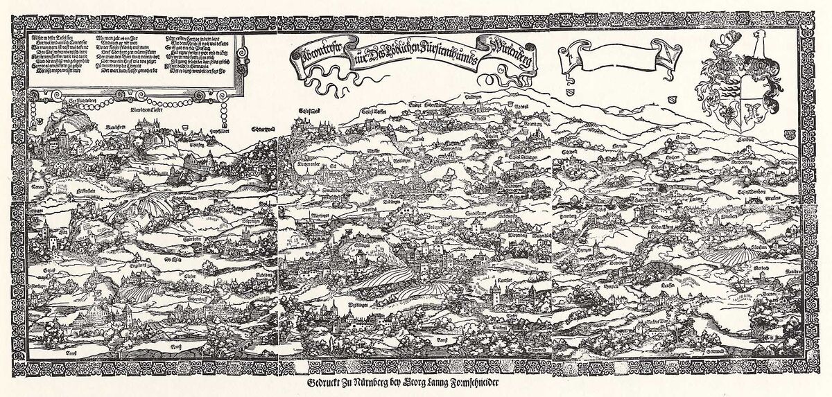
The mapping of princely lands was essential to the formation of institutionalized territorial states. This map from 1537 shows the duchy of Württemberg. Stuttgart, the capital of the territory, is at the bottom center of the image. Tübingen, the second most important town, is in the upper right behind the walls of its castle [Schloss]. A string of castles that guarded the duchy extends from Tübingen to the west.
Source: Hans Schäufelein, map of Württemberg, wood engraving, c. 1537. Grafische Sammlung Albertina, Vienna. Available online at: http://www.zeno.org/nid/2000427721X