Abstract

This map shows how the German Reich (as of January 1, 1900) was divided up into larger and smaller administrative districts. The large grey mass across the north of Germany is the Kingdom of Prussia; the blue area in the southeast is the Kingdom of Bavaria (Germany’s second-largest federal state); and the light green area near the center of the map is the Kingdom of Saxony (third-largest by population).

Administrative Districts in the German Reich in 1900

Source

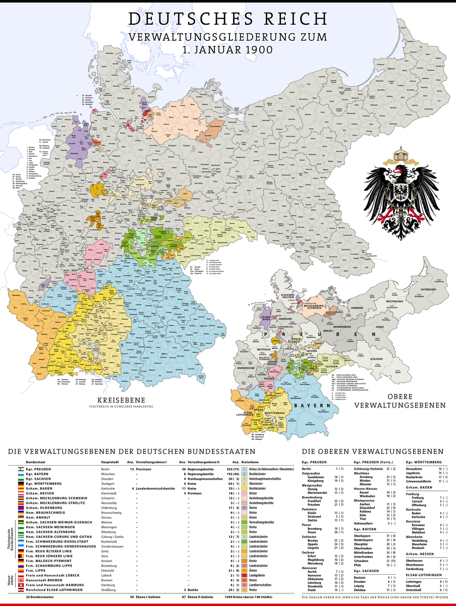
Source: “Deutsches Reich. Verwaltungsgliederung zum 1. Januar 1900” [“German Reich. Administrative Districts as of 1. January 1900”]. Cartographer: Maximilian Dörrbecker. https://upload.wikimedia.org/wikipedia/commons/1/17/Karte_Deutsches_Reich,_Verwaltungsgliederung_1900-01-01.png

Wikimedia Commons