Abstract

This map of Prussian territory in 1866 shows the constituencies in which voting for deputies to the Prussian Landtag took place on the very day of the Battle of Königgrätz (July 3, 1866). That election is notable because—even before voters could have known about Prussia’s victory over Austria—the liberal parties in the lower house of the Prussian parliament suffered a setback (they had been opposing Bismarck in the “Constitutional Struggle” since 1861). From the map and the colors designating the political affiliation of elected deputies, one can see the strength of the Conservative Party (in dark blue), especially in the east; the election of Polish deputies in eastern Prussia (purple); and the victories of the Progressive Party and other liberals in western parts of Prussia (yellow and light blue).

Map: Elections to the Prussian House of Deputies (July 3, 1866)

Source

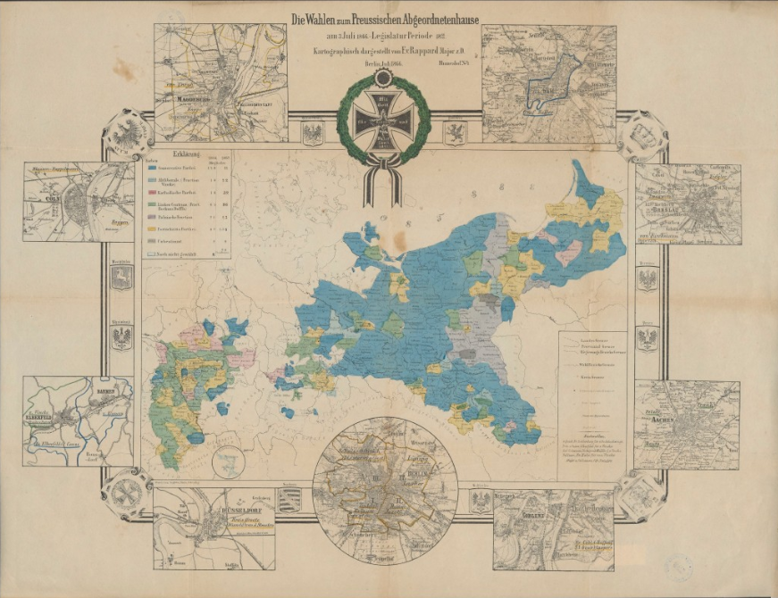
Source: “Die Wahlen Zum Preussischen Abgeordnetenhause am 3. Juli 1866. Legislatur Periode 1866/69. Kartographisch dargestellt von F. v. Rappard Major z.B. Berlin, Juli 1866 (2. Auflage)” [“The Elections to the Prussian House of Deputies on July 3, 1866. Legislative Period 1866/69. Cartographically Depicted by F. v. Rappard Major z.B. Berlin, July 1866 (2nd Edition)”].
Available online at: Universitäts- und Landesbibliothek Sachsen-Anhalt,
https://dx.doi.org/10.25673/39074,