Abstract

This 1778 map of the city of Vienna drawn by Josef Daniel von Huber depicts the inner core, the forbidding city walls, and the growing urban sprawl. Note sharp angles of the city walls, which were designed to allow defensive fire to be rained down on enemies from multiple angles. Also note the defensive moat created by the diversion of the Danube River.

Vienna City Map (1778)

Source

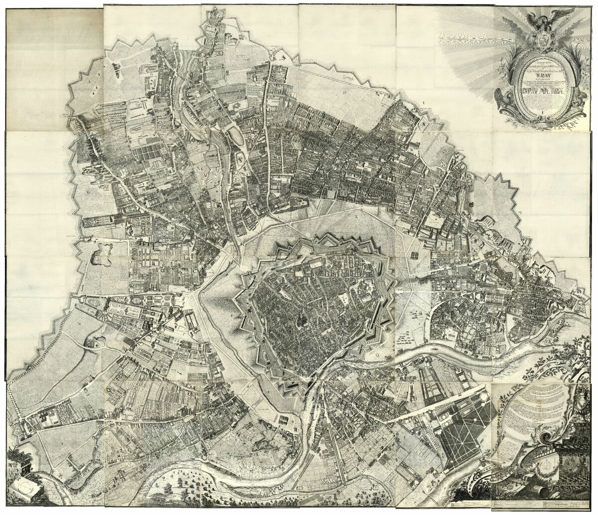
Source: Josef Daniel von Huber, Scenographie oder Geometisch-Perspect. Abbildung der Kays Königl. Haupt und Residenz Stadt Wienn in Oesterreich auf allerhöchsten Befehl aufgenommen und gezeichnet vom Jahr 1769 May Monats bis letzten October 1772, engraving, Vienna 1778. Austrian Academy of Sciences
https://viewer.acdh.oeaw.ac.at/viewer/image/AC04408812/1/

ÖAW

Vienna City Map (1778), published in: German History in Documents and Images, <https://germanhistorydocs.org/en/the-holy-roman-empire-1648-1815/ghdi:image-5277> [July 13, 2024].