Abstract

This map shows why Catholics in the German Empire [Reich] felt marginalized—figuratively and literally. Areas where Catholics made up a high proportion of the population included most of Bavaria, the Rhineland, and the provinces taken from France in 1871 (Alsace, Lorraine). In the east, a more heterogeneous mix of confessions reflected the interpenetration of ethnic Germans and Poles. Because Catholics were most prevalent in these “borderlands,” it was all the easier for Bismarck and German liberals to stigmatize them as “enemies of the Empire" [Reichsfeinde].

Geographical Distribution of Protestants and Catholics (1890)

Source

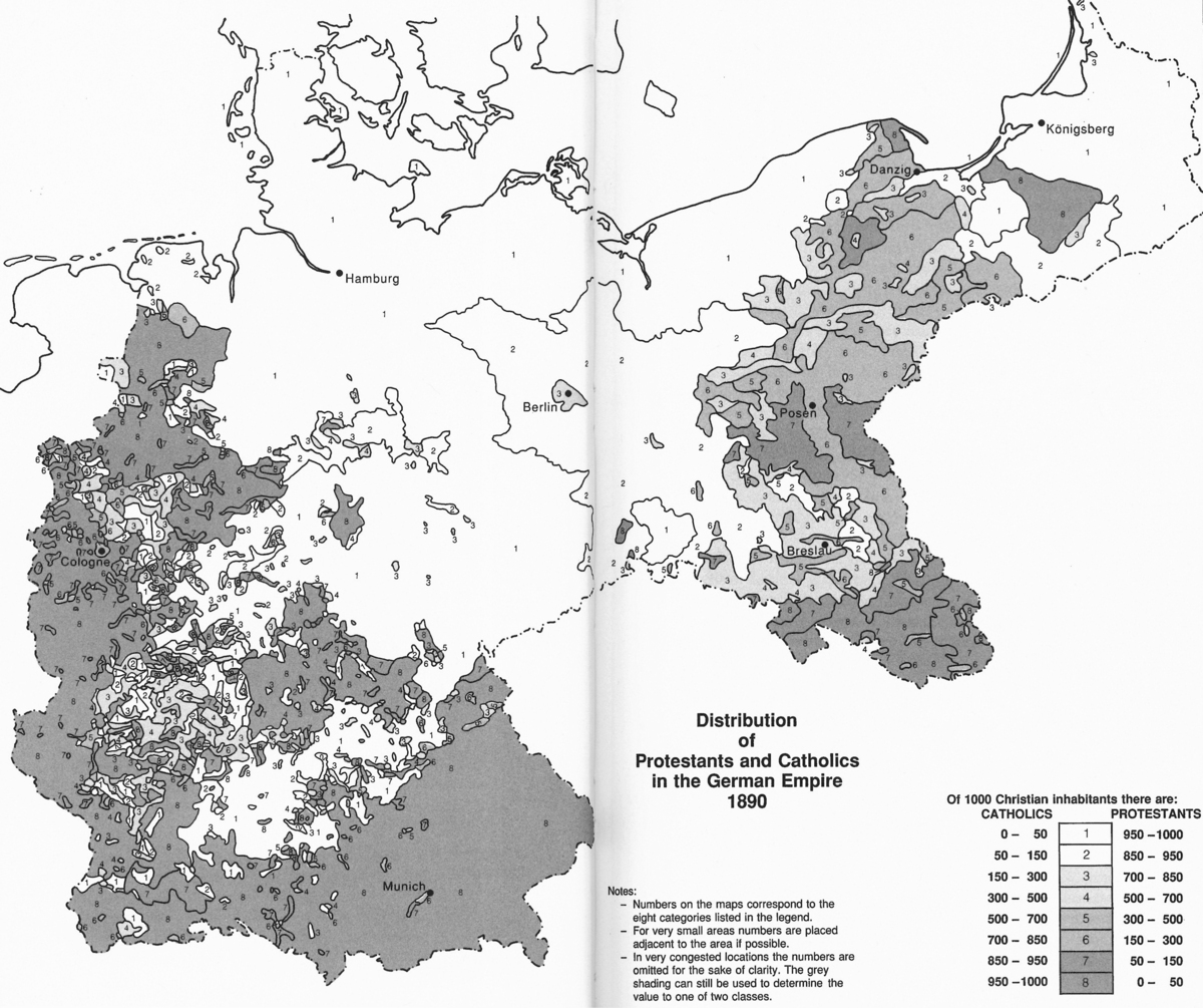
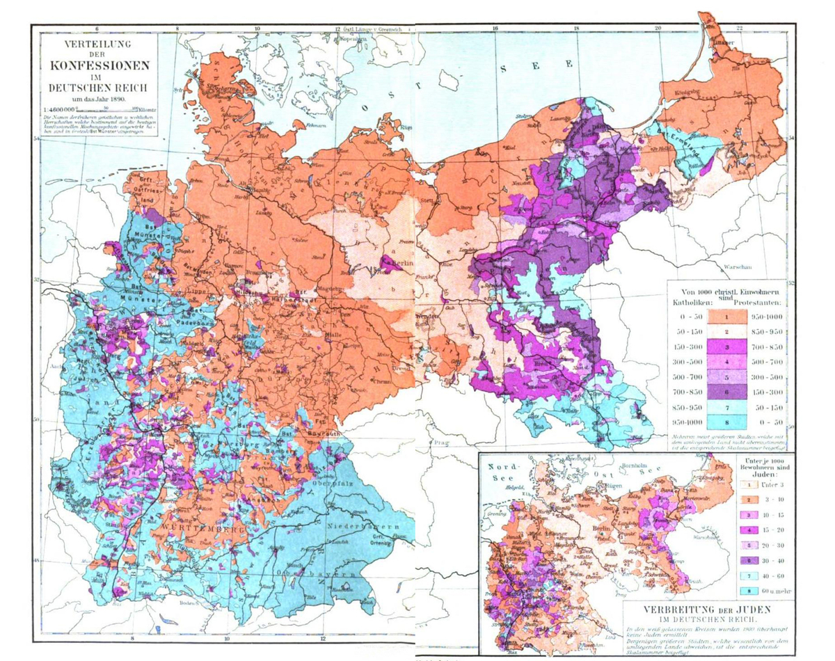
Source: Map 1: Verteilung der Konfessionen im Deutschen Reich um das Jahr 1890, in Meyers kleines Konversations-Lexikon, 7. gänzlich neubearbeitete und vermehrte Auflage. Leipzig und Wien, Bibliographisches Institut, 1908. Bd. 2., pp. 332–33. Map 2: Translated and redrawn version reprinted in Helmut Walser Smith, German Nationalism and Religious Conflict: Culture, Ideology, Politics, 1870–1914. Princeton: Princeton University Press, 1995, pp. 2–3.