Abstract
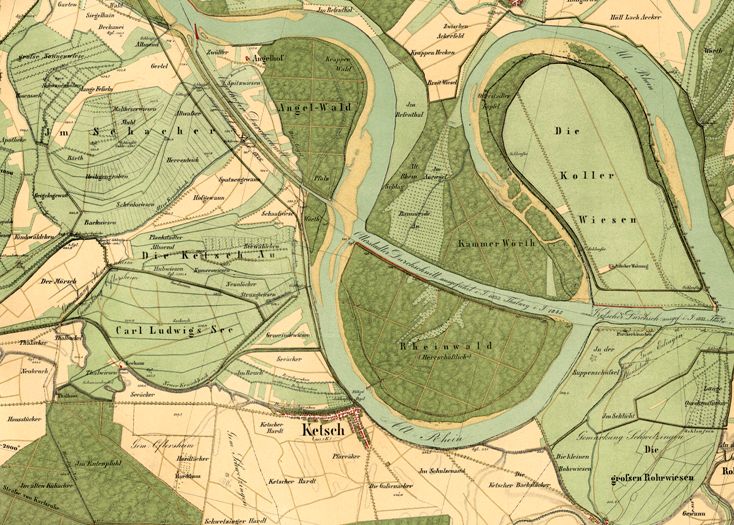
This map shows the engineering works to cut through a meandering portion of the Rhine near the village of Ketsch in Baden as part of the so-called rectification of the Rhine (1817–1876). Associated with the engineer <a href="document-5007">Johann Gottfried Tulla </a> (1770–1828), the project aimed to narrow and straighten the river’s course to control flooding and win back agricultural land. Once the ditches were dug, they could be opened to allow the Rhine to flow through, whereby the force of the water would start to widen and deepen the new channel. The old arms would tend to dry up, becoming meadows and agricultural land, or perhaps gravel pits, and would only flood at times of particularly high water, and thus less frequently (the planners hoped) than in the past. In this case, near Ketsch, some of the old watercourses persisted as tributaries at lower volumes or became small lakes.