Abstract
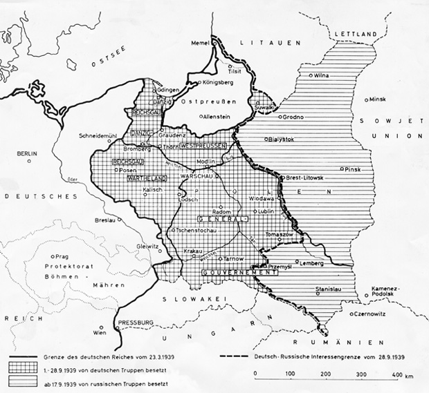
On September 28, 1939, Ribbentrop and Molotov signed the so-called
German-Soviet Boundary and Friendship Treaty as a supplement to the
“territorial and political transformation” of Eastern Europe to which
they had already agreed on August 23, 1939. This map shows the final
demarcation line between the two aggressors’ spheres of interest, which
ran along the Narew, Bug and San rivers. The Eastern part of Poland,
inhabited mainly by Belorussians and Ukrainians, was annexed to the
Belorussian and Ukrainian Soviet Socialist Republics. The Nazi
government incorporated the new districts of Wartheland and Danzig-West
Prussia into the German Reich and subjected the rest of the territory to
brutal German occupation rule under the “General Government.” Shortly
thereafter, Stalin began to forcibly establish military bases in the
Baltic states, which were eventually occupied by the Soviet Union in
June 1940 and finally annexed as Soviet republics.