Abstract
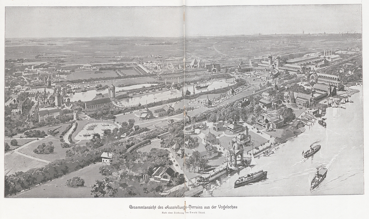
The first image in this gallery presents an aerial view of the Berlin
Industrial Exhibition of 1896. It shows the artificial lake, with the
Main Exhibition Hall at one end, and the Main Restaurant at the other.
On the left are the reconstructed medieval towers of Old Berlin, and
across the Carp Pond, the artificial “authentic native villages” of the
Colonial Exhibition. In the background are the reconstructed pyramids of
the Special Exhibition Kairo. In the foreground to the left is the giant
27” telescope (a highlight of the exhibition) and the scale-model
battleships of the Naval exhibit.
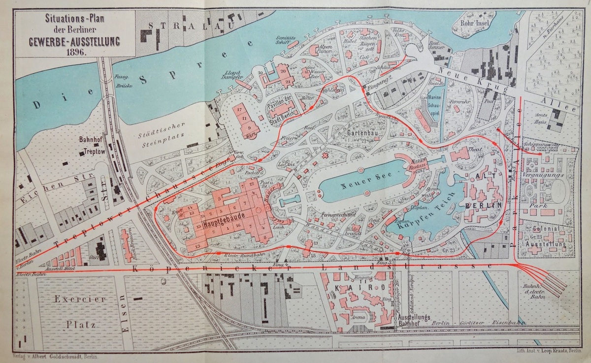
The second image is a map from a
popular German guidebook for tourists. It offers a two-color, top-down
overview of the main exhibition halls, the exhibition grounds, and the
adjacent expositions, including the Special Exhibition Kairo, the
Colonial Exhibition, and the Amusement Park. The route of the electric
train is also delineated.