Abstract

This map accompanied a 1919 pamphlet titled “Europe at the Abyss: Explaining the main provisions of the Versailles Treaty and its effects,” the introduction to which was dated June 1919, the very same month in which the Treaty of Versailles was signed.

The map highlighted in red the areas that the Treaty required Germany to cede immediately to neighboring countries without a plebiscite; in blue the areas for which the Treaty required a vote of inhabitants (a plebiscite); in green the Saar Valley, whose inhabitants could only vote in a plebiscite on their future after 15 years of rule by the League of Nations (which the map refers to as “foreign rule”); and in diagonal black lines the areas that victorious powers in World War I had occupied since the end of the war. The map also noted the losses to Germany of specific commodities produced in each area, including coal, iron, potash, cattle, milk, bread, potatoes, and butter.

“The Dismemberment of Germany” (1919)

Source

The Dismemberment of Germany.
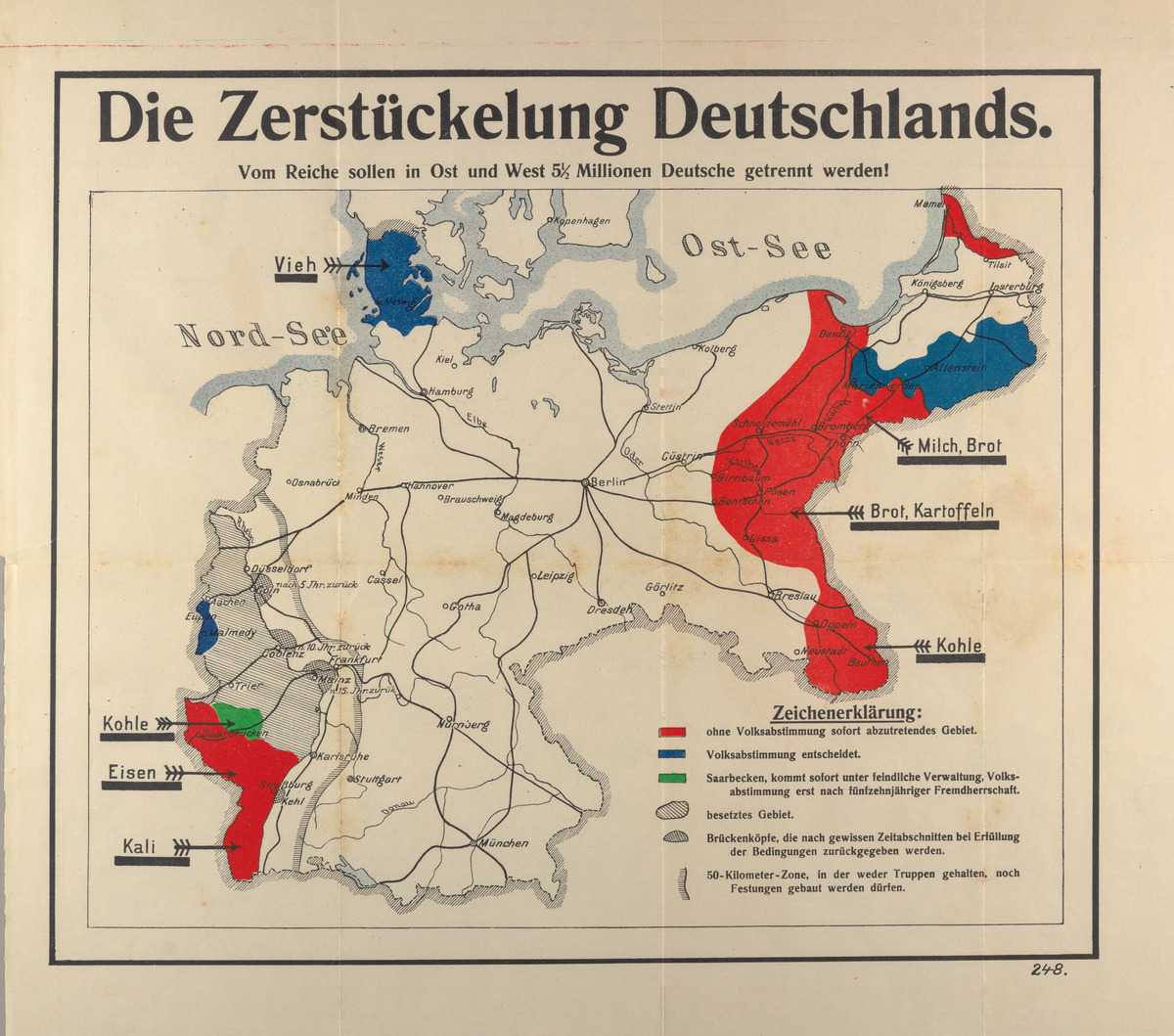
5 1/2 million Germans are to be separated from the Reich in East and West.
Legend:

[red] Territory to be immediately transferred without a plebiscite

[blue] To be decided by a plebiscite

[green] The Saar Basin region is immediately placed under enemy administration; a plebiscite will not occur until after fifteen years of foreign rule.

[] Occupied territory

[] Bridgeheads that will be returned after a certain period of time and fulfilling the terms [of the treaty]

[] 50 Kilometer Zone in which neither troops may be stationed, nor forts built.

Source: Europa am Abgrunde. Die wichtigsten Bestimmungen des Versailler Friedensvertrages in ihren Wirkungen erläutert. Ed. Paul Rühlmann. Leipzig: K. F. Koehler, 1919. Available online at: https://digital.library.cornell.edu/catalog/ss:3293943