Source
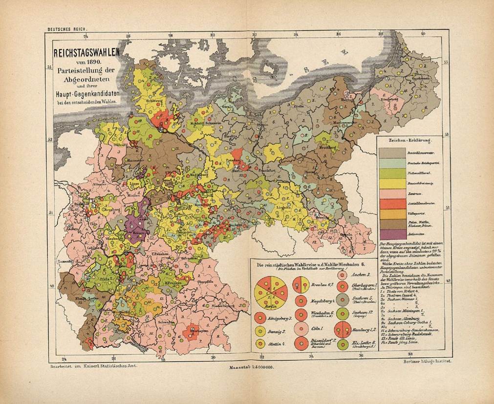
Source: Map 1: Kaiserliches Statistisches Amt, ed.,
Statistisches Jahrbuch für das Deutsche
Reich, Jg. 11 Berlin: Puttkamer & Mühlbrecht, 1890, Beilage,
“Reichstagswahlen von 1890. Parteistellung der Abgeordneten und ihrer
Haupt-Gegenkandidaten bei den entscheidenden Wahlen.” Available online
at:
http://redsaxony.utoronto.ca/Map_S.6.6_Reichstagswahlen_von_1890.htm
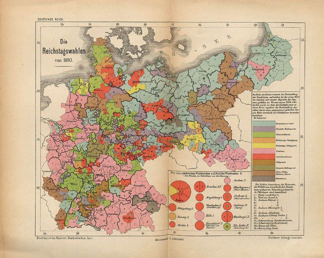
Map
2: Kaiserliches Statistisches Amt, ed.,
Statistisches Jahrbuch für das Deutsche
Reich, Jg. 15. Berlin: Puttkamer & Mühlbrecht, 1894, Beilage,
“Die Reichstagswahlen von 1893.” Also:
http://redsaxony.utoronto.ca/Map_S.6.7_Die_Reichstagswahlen_von_1893.htm
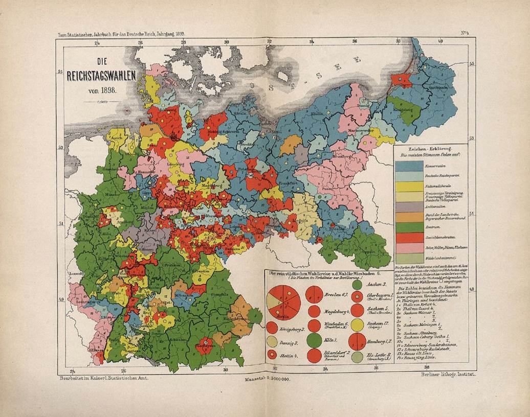
Map
3: Kaiserliches Statistisches Amt, ed.,
Statistisches Jahrbuch für das Deutsche
Reich, Jg. 20. Berlin: Puttkamer & Mühlbrecht, 1899, 4.
Graphische Darstellung, “Die Reichstagswahlen von 1898.” Also:
http://redsaxony.utoronto.ca/Map_S.7.4_Die_Reichstagswahlen_von_1898.htm